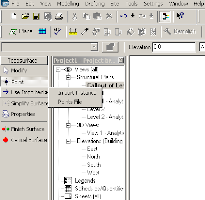
If you can obtain a csv (Points File) from the surveyor which contains coordinate points, this can be used to create a Revit topography surface.
If you can obtain a dwg with contours (polylines at proper Z elevations) you can import that and use the Import Instance function to create a toposurface. Keep in mind that the contours usually come in at the geodetic height unless otherwise edited. You may want to bring it closer to a zero Z elevation in AutoCAD before importing it for easy use.
If you choose to use a dwg with polyline contours as the topography base do the following things...
Open the dwg in AutoCAD and isolate the layer with the contours
Erase any non-essential info
purge, audit and save the dwg
In Revit:
Start the Toposurface Tool
Import/Link CAD Formats-Choose the contour dwg
Click Use Imported from the sidebar menu
Select Import Instance
Finish Sketch


No comments:
Post a Comment